Property Record
3521 Wright Way Rd, Dayton, OH 45424


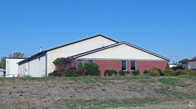
Property Detail
3521 Wright Way Rd
Dayton, OH
PT 79884
R72205018-0005
Montgomery
Industrialgeneral
Ohio
A Areas with a 1% annual chance of flooding and a 26% chance of flooding over the life of a 30-year mortgage.
5
2024
0.85 AC
2025
Northeast Cent Dayton
090302
Cincinnati/Dayton
9,612 SF
NEARBY LISTINGS FOR SALE OR LEASE
DEMOGRAPHICS near 3521 Wright Way Rd
1 mile
3 mile
5 mile
2024 Total Population
5,397
50,455
163,182
2029 Population
5,389
50,881
164,987
Pop Growth 2024-2029
(0.15%)
+ 0.84%
+ 1.11%
Average Age
39
36
38
2024 Total Households
2,189
20,622
68,715
HH Growth 2024-2029
(0.18%)
+ 1.10%
+ 1.18%
Median Household Inc
$81,556
$56,452
$57,774
Avg Household Size
2.40
2.30
2.30
2024 Avg HH Vehicles
2.00
2.00
2.00
Median Home Value
$220,395
$166,949
$155,241
Median Year Built
1982
1973
1964
Nearby Places
Map Layers
Map Styles
 Street
 Aerial
Transit
 Traffic
 Biking
Places
Listings with unknown addresses are not visible on the map
- Restaurants
- Banks
- Shops
- Fitness
- Groceries
PUBLIC TRANSPORTATION
AIRPORT
James M Cox Dayton International
Drive
Walk
Distance
James M Cox Dayton International
24 min
14.3 mi
Nearby Properties
Address
Land Use
TOTAL SIZE
Lot Size
Zoning
Address
Land Use
TOTAL SIZE
Lot Size
Zoning
14.22 AC
Address
Land Use
TOTAL SIZE
Lot Size
Zoning
316.77 AC
Address
Land Use
TOTAL SIZE
Lot Size
Zoning
22,133 SF
47.58 AC
Address
Land Use
TOTAL SIZE
Lot Size
Zoning
33,504 SF
14 AC
Address
Land Use
TOTAL SIZE
Lot Size
Zoning
133.37 AC
Address
Land Use
TOTAL SIZE
Lot Size
Zoning
46,796 SF
53.05 AC
RPUD038
Address
Land Use
TOTAL SIZE
Lot Size
Zoning
54.85 AC
Address
Land Use
TOTAL SIZE
Lot Size
Zoning
46.32 AC
Address
Land Use
TOTAL SIZE
Lot Size
Zoning
32.30 AC
Address
Land Use
TOTAL SIZE
Lot Size
Zoning
111,938 SF
10.03 AC
Address
Land Use
TOTAL SIZE
Lot Size
Zoning
2,376 SF
18.75 AC
PD1
Address
Land Use
TOTAL SIZE
Lot Size
Zoning
18,087 SF
19.69 AC
Address
Land Use
TOTAL SIZE
Lot Size
Zoning
96,732 SF
6.73 AC
CPUD002
Address
Land Use
TOTAL SIZE
Lot Size
Zoning
18,576 SF
11.66 AC
Address
Land Use
TOTAL SIZE
Lot Size
Zoning
94,608 SF
7.44 AC
Address
Land Use
TOTAL SIZE
Lot Size
Zoning
1,200 SF
4.25 AC
B3
Address
Land Use
TOTAL SIZE
Lot Size
Zoning
22.70 AC
Address
Land Use
TOTAL SIZE
Lot Size
Zoning
19,008 SF
19.96 AC
PD1
Address
Land Use
TOTAL SIZE
Lot Size
Zoning
93,360 SF
694.57 AC
Address
Land Use
TOTAL SIZE
Lot Size
Zoning
9,840 SF
8.83 AC
PD1
Address
Land Use
TOTAL SIZE
Lot Size
Zoning
Address
Land Use
TOTAL SIZE
Lot Size
Zoning
21.53 AC
Address
Land Use
TOTAL SIZE
Lot Size
Zoning
67,094 SF
5.12 AC
Address
Land Use
TOTAL SIZE
Lot Size
Zoning
203,730 SF
24.23 AC
CPUD904
Address
Land Use
TOTAL SIZE
Lot Size
Zoning
66,042 SF
9.47 AC
Address
Land Use
TOTAL SIZE
Lot Size
Zoning
2,034 SF
23.83 AC
Address
Land Use
TOTAL SIZE
Lot Size
Zoning
Address
Land Use
TOTAL SIZE
Lot Size
Zoning
401.86 AC
Address
Land Use
TOTAL SIZE
Lot Size
Zoning
139,400 SF
20.26 AC
Address
Land Use
TOTAL SIZE
Lot Size
Zoning
28,228 SF
3.99 AC
The World's #1 Commercial Real Estate Marketplace
Connect with us
© 2026 CoStar Group
The information above has been obtained from sources believed reliable. While we do not doubt its accuracy we have not verified it and make no guarantee, warranty or representation about it. It is your responsibility to independently confirm its accuracy and completeness. Any projections, opinions, assumptions, or estimates used are for example only and do not represent the current or future performance of the property. The value of this transaction to you depends on tax and other factors which should be evaluated by your tax, financial, and legal advisors. You and your advisors should conduct a careful, independent investigation of the property to determine to your satisfaction the suitability of the property for your needs.